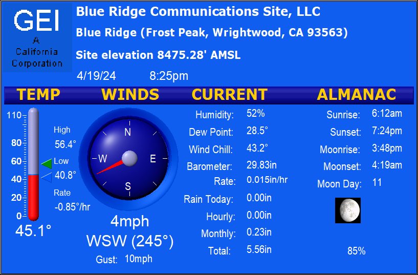
Station Location:
Near the
base
of Heath Canyon
Lat: 34.3535
Lon: -117.6298
6106 ft above sea level
Station data is updated every 5 minutes to this website
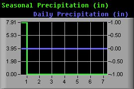
The season rain year begins every year on October 1st and
ends on September 30. WrightwoodCalif.com, Los Angeles
Department of Public Works and the Forest Service use these
dates for the rain season.
All Forest Service RAWS station tipping buckets
automatically reset to 0.00 inches on October 1st of each
year.
We'd like to
thank our friends at AirSites2000.com for allowing us
to use their weather data and livecam images from the
Frost Peak facility. It should be noted that wind
speed and direction have been known to freeze when ice
forms on the equipment and there is no guarantee of
accuracy.
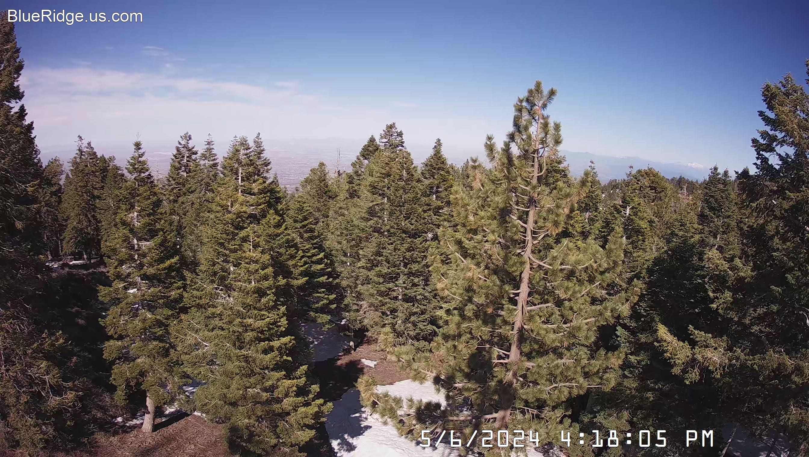
Looking towards the Victor Valley area from Frost
Peak
Wrightwood Weather Station History
12/18/90 - Davis PCW Weather Station
6/3/92 - Weather Monitor II & Weatherlink
6/9/94 - Weatherlink Upgrade & Remote Display
10/17/05 - Davis Tipping Bucket Rain gage with custom heater
1/2007 - The current weather station is a wireless Davis Vantage
Pro2.
A separate Davis rain gage has been custom fitted with 3 low
wattage heaters
to insure accurate precipitation measurements during the heaviest
snowfall.
If all 3 heaters are energized = 160 watts.
Photo 1 2
3 4 5
6 7