Author Topic: GPS apps Waze, Google Maps leading drivers astray to bypass I15  (Read 15224 times)

0 Members and 1 Guest are viewing this topic.

Offline Wrightwood

  • Administrator
  • Raccoon
  • *****
  • Posts: Plenty of Posts!
  • Wildlife Gateway
ABC7 Eyewitness News
?Verified account @ABC7
23 minutes ago

GPS apps like Waze, Google Maps leading drivers astray when they try to bypass I-15 in Cajon Pass https://abc7.la/2zEpSum

LYTLE CREEK, Calif. (KABC) --
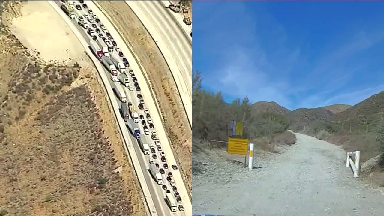
Traffic apps like Google Maps or Waze can be invaluable tools for drivers in Southern California, especially during rush hour. But they can also make a difficult drive even worse, especially in the mountain community of Lytle Creek.

"Google tells them to go up there," said Lytle Creek resident Cheryl Anaya. "And there's no way for a normal car to have access."

Anaya is referring to Lytle Creek Road, which some smartphone traffic apps suggest as an alternate route to Interstate 15 through the Cajon Pass when traffic is jammed. But 11 miles from the freeway, the road narrows and the pavement comes to an end.

"If you have maybe a 10-inch high four-wheel drive you can do it," said resident Dana Koenig. "Try it in a Prius."

Big rigs have no way to turn around either. Which can turn the quiet mountain community of less than 1,000 residents into a bottleneck.

"The roads can't handle it," said Anaya. "We can't handle it."

Residents have complained the bottlenecks can make it impossible for ambulances to get through in the event of an emergency. And for Lytle Creek residents, a 10-minute drive to the freeway can easily top 30 minutes on busy days, all because traffic apps are steering drivers onto streets that won't get them to their destinations.

The problem is well known to county officials.

"People get trapped," said San Bernardino County Supervisor Janice Rutherford. "It's a two-lane road, people can't even make the U-turn, especially the big rigs to get down south."

But Rutherford is hoping for a solution. She said county officials are in talks with Google to put together a memorandum-of-understanding between the app designer and the county, to hopefully prevent the maps from steering drivers through Lytle Creek as an alternative to Interstate 15.

"So their software can be more clear," said Rutherford. "Don't take this way, it's not a short cut, there's no way out."

Rutherford said the county also plans to add more signs along Lytle Creek Road. Residents seem skeptical though that drivers will pay attention to those signs, especially with them being so focused on their smartphones.

"I call it Google hypnosis," said resident Ken Phillips.
Wrightwood Forum is the first & most dependable local social media outlet

Offline Leftfield

  • Raccoon
  • *****
  • Posts: 757
Re: GPS apps Waze, Google Maps leading drivers astray to bypass I15
« Reply #1 on: Sep 29, 18, 07:56:36 AM »
Once in a blue moon, I see someone heading south on Sheep Creek trying to get to the 138 (old route).  They even drive past the barrier.

Offline tlc

  • Bear
  • ****
  • Posts: 308
Re: GPS apps Waze, Google Maps leading drivers astray to bypass I15
« Reply #2 on: Sep 29, 18, 09:23:38 AM »
I can't read the sign but maybe a sign earlier on the road can warn drivers that there's no outlet. Getting in touch with Google and Waze doesn't solve the problem with all the other driving apps out there.

Offline AvocadoFlyer

  • Bear
  • ****
  • Posts: 282
Re: GPS apps Waze, Google Maps leading drivers astray to bypass I15
« Reply #3 on: Sep 29, 18, 12:43:18 PM »

Offline Jim Wilkins

  • Raccoon
  • *****
  • Posts: 1275
  • Looking forward to the next 45 years....
Re: GPS apps Waze, Google Maps leading drivers astray to bypass I15
« Reply #4 on: Sep 29, 18, 01:00:12 PM »
How does one contact Google Maps....do you have to wade through fifty email addresses to get to the right one?

Offline AvocadoFlyer

  • Bear
  • ****
  • Posts: 282
Re: GPS apps Waze, Google Maps leading drivers astray to bypass I15
« Reply #5 on: Sep 29, 18, 06:01:15 PM »

Offline Jirka

  • Squirrel
  • **
  • Posts: 66
Re: GPS apps Waze, Google Maps leading drivers astray to bypass I15
« Reply #6 on: Oct 02, 18, 11:03:02 AM »

Offline Leftfield

  • Raccoon
  • *****
  • Posts: 757
Re: GPS apps Waze, Google Maps leading drivers astray to bypass I15
« Reply #7 on: Oct 03, 18, 02:11:20 PM »
Dont go unto the 15.   You might yourself stuck for hours.  You can go through Crestline unto the 138.  If Crestline is congested or blocked then you may to go via the 14 or Yucca Valley then unto Lucerne Valley.   I know that way can get snowed out too.   

Just hang on....we might have flying cars in a few years or decades....

Offline Tim

  • Mouse
  • *
  • Posts: 12
Re: GPS apps Waze, Google Maps leading drivers astray to bypass I15
« Reply #8 on: Oct 08, 18, 08:19:14 AM »
Whenever traffic get heavier on the pass I take Lytle Creek and go up and over Sheep canyon rd. It was still open last week. I have a truck and a forester, both of them can make it no problem.